
Archaeological Geophysics
Back to ServicesArchaeo-Geophysics is the science of investigating the subsurface using various techniques like magnetic survey, gravity, Ground Penetrating Radar, EM etc. Geophysical methods are inherently non-destructive and this very nature of geophysics makes it an ideal tool for archaeologists. The benefits of geophysics for archaeological studies and summarized as under
The Benefits of Geophysics for Archaeology
| Archaeological Excavation | Geophysical Surveying |
|---|---|
| Inherently destructive | Inherently non-intrusive and nondestructive |
| Relatively expensive in cost per acre | Relatively inexpensive in cost per acre |
| Data often represent a few tiny windows into the subsurface | Complete site coverage is feasible |
| Characterization of large features or structures is difficult (the “Blind Men and the elephant” problem) | Large features can be completely mapped |
| Complete data collection on multi-layer or multi-component sites can take years | Complete data collection on multi-layer or multi-component sites can be done in hours to days |
| Horizons or features typically recognizable only by color and/or texture | Horizons or features can be recognized by very subtle differences in texture, moisture content, mineralogy, compaction, magnetization, magnetic susceptibility, electrical conductivity, dielectric properties, or density |
| Reconnaissance or prospecting is often a “needle in a haystack” proposition | Complete site coverage produces rapid, high confidence prospecting |
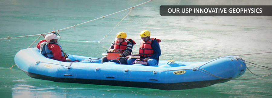
| Difficult to impossible on many flooded sites | Geophysics is equally effective for underwater and underground targets |
| Artifacts and features can be positively identified | Artifacts and features cannot generally be identified based on geophysics alone |
| Minute artifacts can be detected and recovered | The deeper an artifact or feature, the larger it must be to be detectable |
Archaeological studies typically require painstaking, manual labor. Sites are carefully exposed level-by-level, in discrete excavations, with the precise positions of features and artifacts laboriously recorded or catalogued. This process is chronically under-funded, and is increasingly done under schedules that do not allow archaeologists sufficient field time. Furthermore, archaeology also faces a paradox – the careful recovery of subsurface data requires the systematic destruction of a site.
Geophysics can help to address all three problems: lack of funding, lack of time, and site destruction.
Nondestructive geophysical methods can provide rapid, effective prospecting for potential archaeological sites. Within a site, geophysical mapping can help archaeologists discriminate artifact- or feature-bearing (versus culturally barren or sterile) zones. All of this allows the archaeologist to establish digging priorities that will provide the maximum cultural data on a limited budget and schedule.
If a large structure or feature is encountered in only a few excavations, interpretation of the structure can be a bit like the blind men and the elephant (who variously identify the elephant as a snake, a spear, a pillar, a wall, a fan, and a rope). Geophysical mapping can connect discrete excavation windows into a feature, and help to fully delineate laterally extensive features such as walls, roads, waterways, and tunnels whose true extent and nature cannot be efficiently or correctly determined by probing.
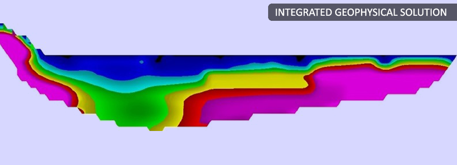
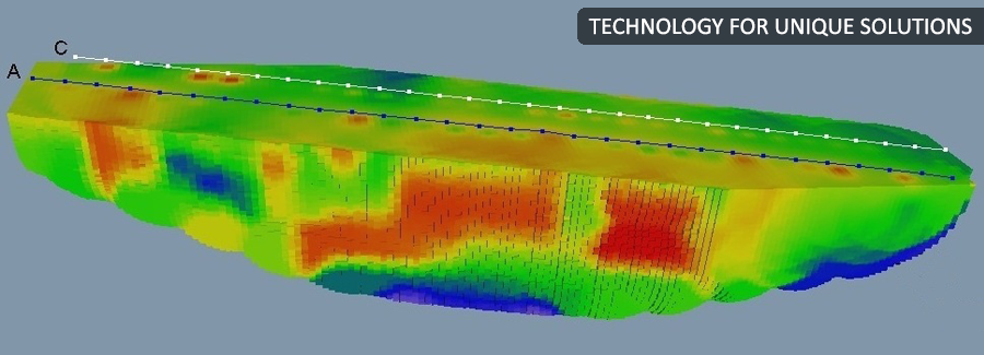
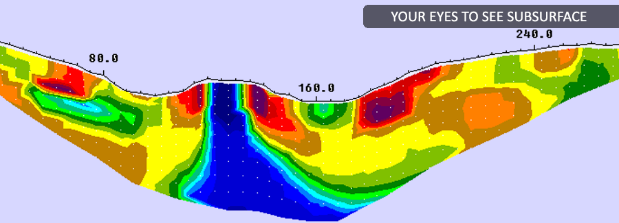
Where sites or features are already known, detailed 2-D or 3-D subsurface imaging can provide information on the undisturbed or in-situ configuration of the feature, the site stratigraphy, and sometimes, the distribution of artifacts. Some archaeological sites cannot be excavated. The site may be covered by modern development, be incorporated into later structures (e.g. corner stones), or be culturally or politically sensitive, sacred, or ceremonial. In these cases, non-intrusive geophysics may be the only method of locating, documenting, and interpreting the site
Currently, much archaeology is done as a salvage operation. While developers, builders, utility companies, and legislators recognize the benefits of identifying and documenting potential archaeological resources before a site is destroyed, the required construction schedule often allows far too little time for a complete and careful investigation and (if necessary) excavation of a site. Geophysical prospecting can speed the investigation process, and imaging can record discovered sites for analysis even after the site itself is gone.
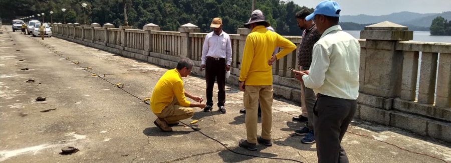
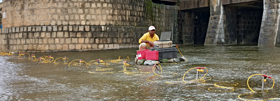
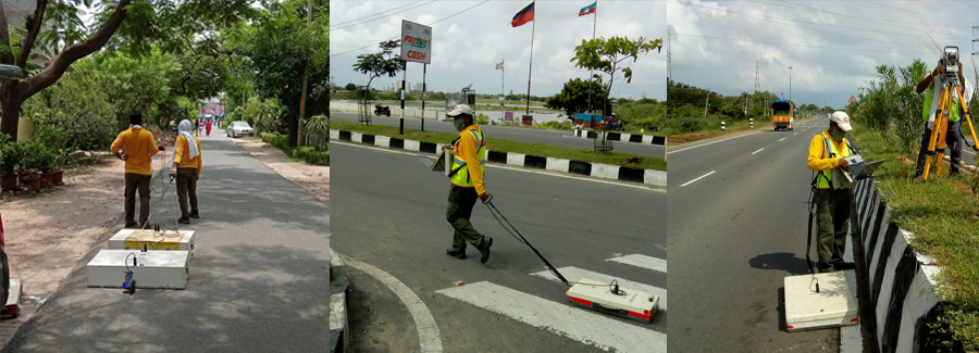
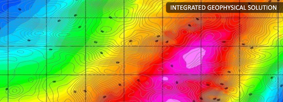
The geophysical techniques available for archaeological studies are listed in table below. Since geophysics basically detects objects that have different physical properties (e.g. density, electrical conductivity, moisture content, etc.) than their surroundings, nearly any feature or artifact that could be recognized in an excavation can be detected by some geophysical technique as long as its size to depth ratio is large enough (i.e. the deeper a target, the larger it must be to be detectable).
Geophysical Techniques for Archaeology
| Method | Sensitive To... | Typical Targets | Typical Application | Typical Environment |
|---|---|---|---|---|
| Magnetic Mapping | Iron or iron-bearing materials, oxidized soils, fired materials, compacted soils | Hearths or fire pits, burned structures, iron artifacts, oxidized soils | Prospecting | Land or water |
| Electromagnetic Mapping | Metals, moisture content variations, clay vs. sand soils, organic material, stones in soil | Foundation remnants, well-shafts or privies, artifact caches | Prospecting | Land |
| Resistivity Methods | Metals, moisture content variations, clay vs. sand soils, organic material, stones in soil | Foundation remnants, well-shafts or privies, artifact caches, tunnels or shafts, soil horizon thicknesses | Prospecting or Imaging | Land or water |
| Seismic Methods | Large stones, compacted soils, cavities, organic lenses | Foundation remnants, floors, tunnels or shafts, soil horizon thicknesses | Imaging | Land or water |
| Microgravity | Stone, compacted soils, cavities, large organic lenses | Tunnels, shafts, vaults, buried rock structures | Prospecting | Land |
| Ground Penetrating Radar | Differences in nearly any physical property | Nearly anything underground with sufficient size relative to depth | Prospecting or Imaging | Land |
| Sonar | Differences in density or surface roughness | Nearly anything underwater | Prospecting or Imaging | Water |
PARSAN uses following tools for high resolution mapping of sub-surface, providing detailed images and information on buried artifacts, foundations and other archaeological objects:
